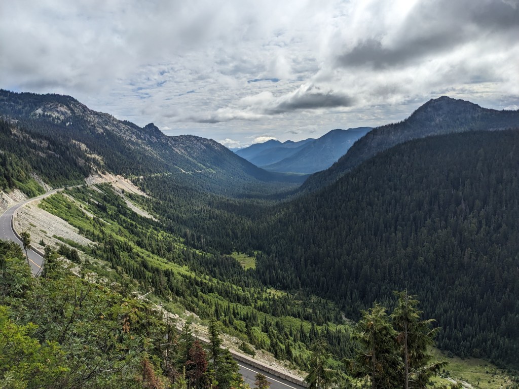
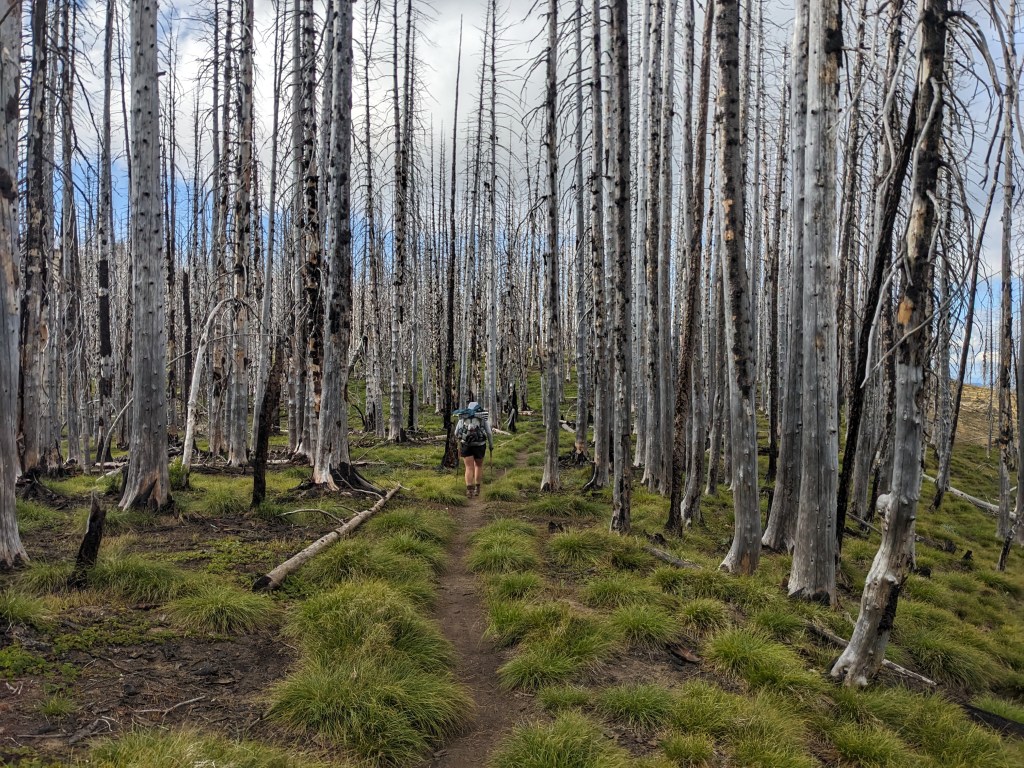
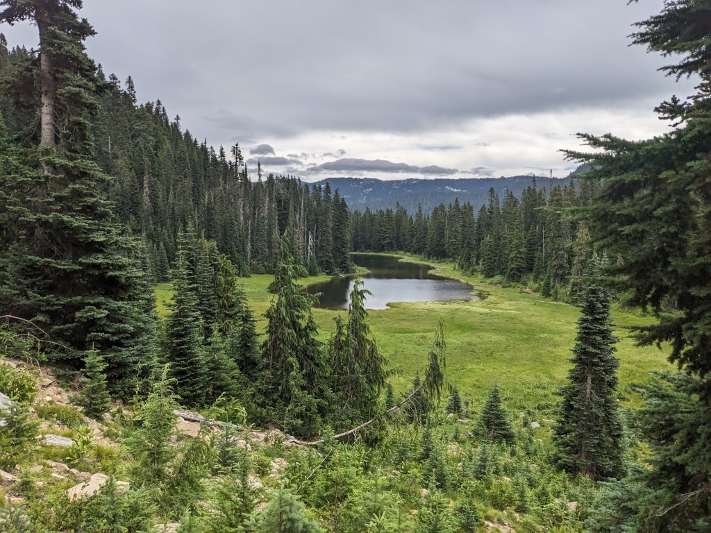
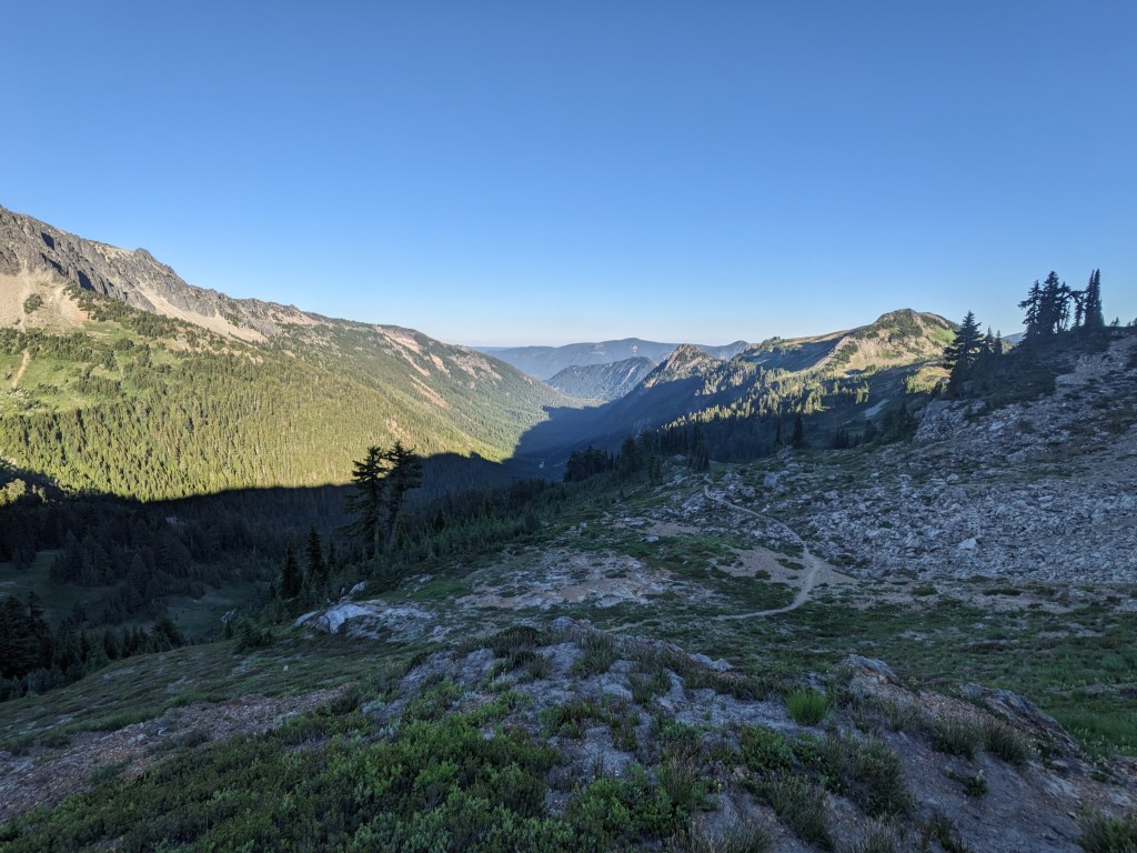
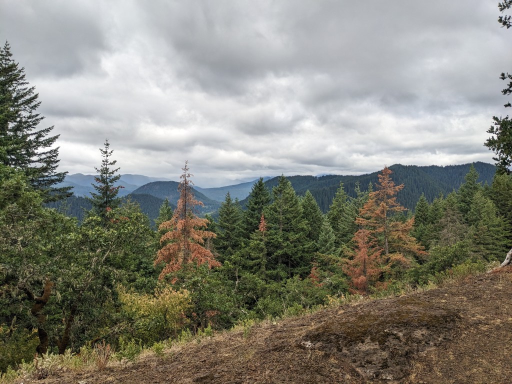
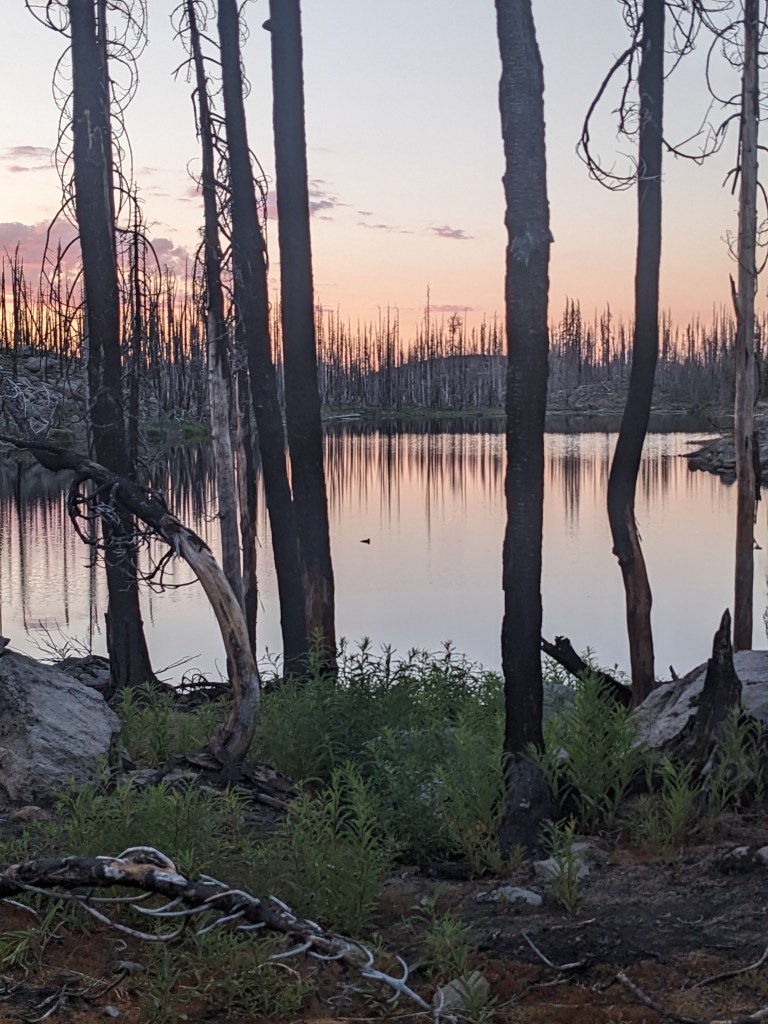
22 miles The night went on without any more rain. We both got up to pee at one point and so I got out of the tent first. When I got out there I could see eyes reflecting back, a deer. When we got back to the tent, I learned that she knew there was something walking around outside, but didn’t bother to tell me before I got up. We made our way down to Chinook Pass, lots of dayhikers as we got near the parking lot. The miles today were cold and in a cloud, but mild ups and downs throughout. No real rain, but we had jackets on for the wind. Camp is kinda windy, damp, and cold. PNW weather.
Chinook PassSourdough GapInto a cloudThrough some burn on our way to camp
20 miles The first few miles were easy, but 10 minutes or so into the climb for the day, it started lightly raining. We stopped to yardsale our stuff on the side of the trail so we could get our rain gear to the top of our packs and the rest of our stuff into a plastic bag/pack liner. We only had to walk a few more miles before lunch, and it stopped raining for the half hour that we stopped. The rest of the afternoon was drizzly as we dropped down to Dewey Lake. Yardsale and Chickadee made it to camp and already had their tent set up when we rolled in. We got ours pitched and then immediately changed into dry clothes. Dinner was beef ramen, a Costco granola bar, a Clif bar, and a Lenny & Larry cookie. Rain makes me focus on just getting the miles in so we can get to camp, and in the process I tend to skip water and snacks. Playing catch up by eating a bunch was nice though and it helped me warm up.
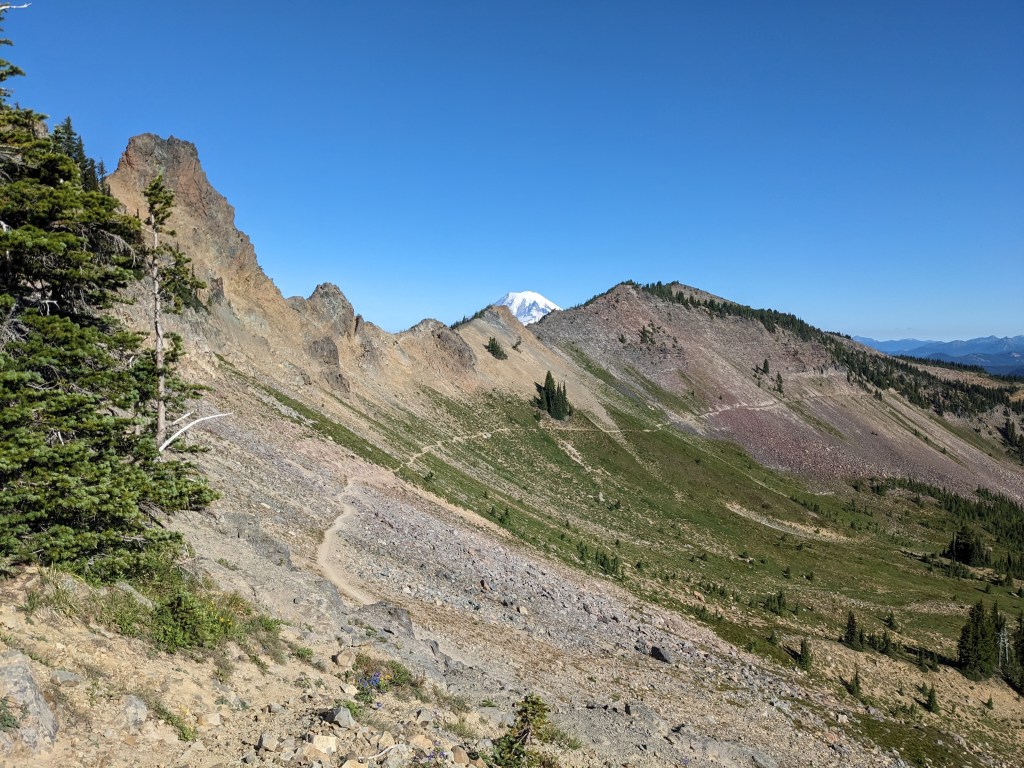
14 miles A smooth 8 miles to the highway, with perfectly clear views of the Knife’s Edge and Rainier. Once we got to the road it seemed like chaos. A hiker in front of us crossed the highway, but didn’t seem to care if there were cars coming. Luckily, the car coming toward her was able to slow down in time to miss her. And then we see a car walking 3 puppies. The car was rolling along the shoulder and the puppies were on leashes hanging out the window. They eventually stopped and got out of the car with the leashes, and then crossed the highway as slow as can be and another car had to slam on their brakes to avoid hitting her. This was all within the half mile of road between the trail and the Kracker Barrel. Just insanity. It was a relief to be at the Kracker Barrel to get the first of 3 resupply boxes we shipped ahead from Anchorage. We got showers, did laundry, repacked our food, ate a pizza, and drank a few beers. It was great. We even hiked back out for 6 more miles. Good, full day.
Looking back at Old Snowy and the Knife’s EdgeWorking our way down to the highwayCar “walking” their puppies and the hiker that doesn’t know to look both ways when crossing the street
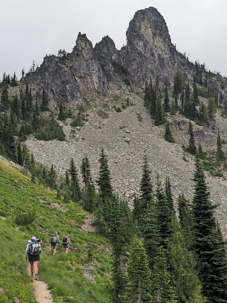
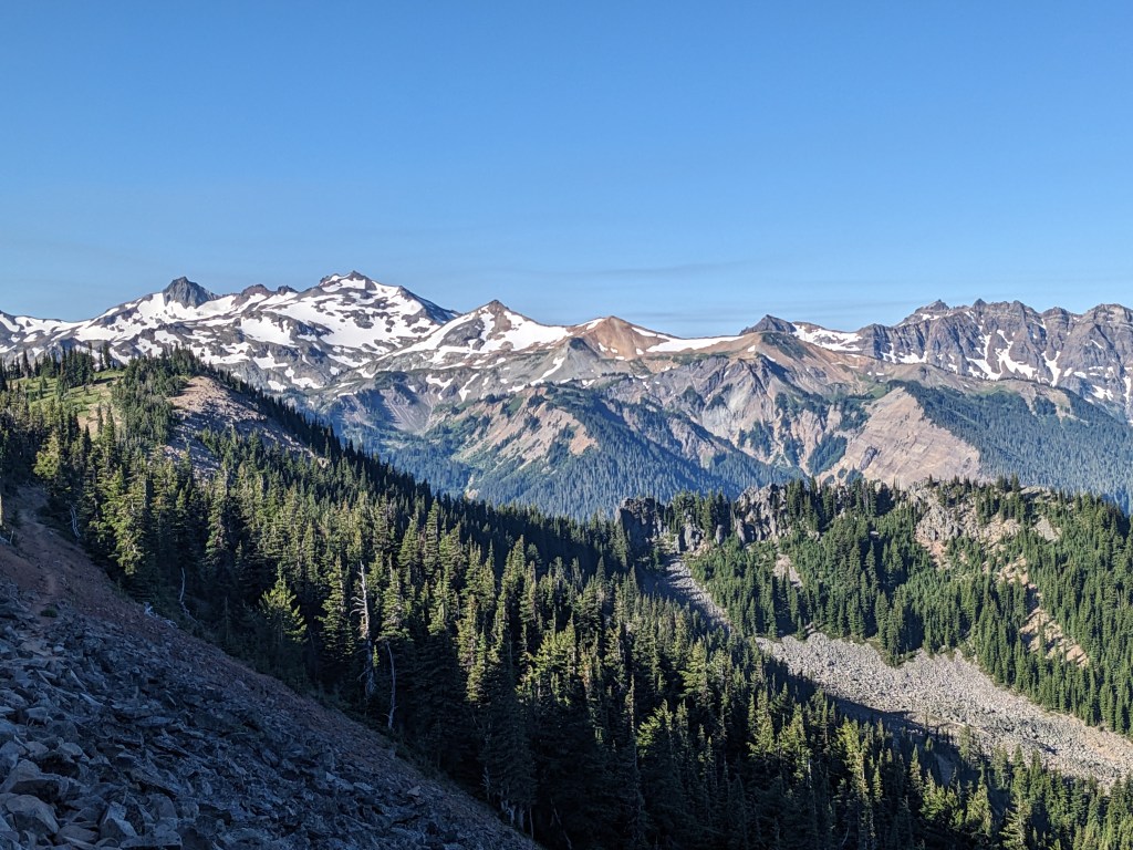
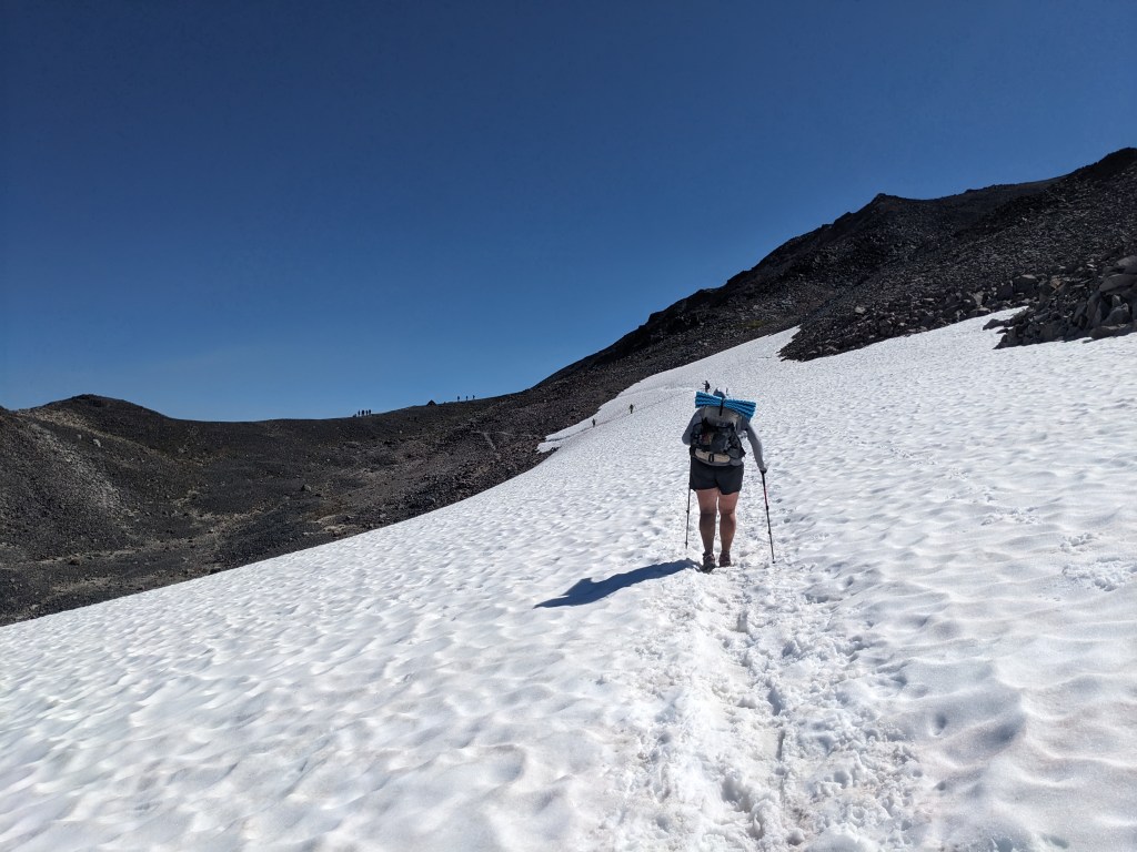
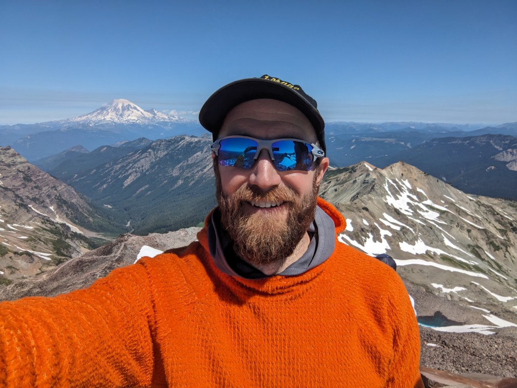
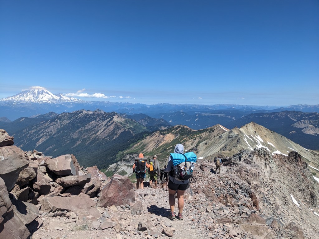
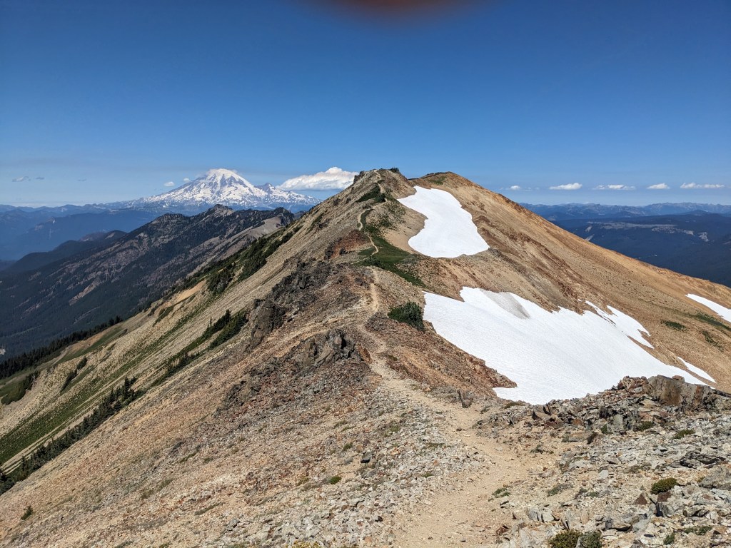
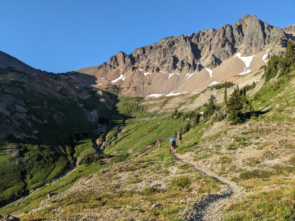
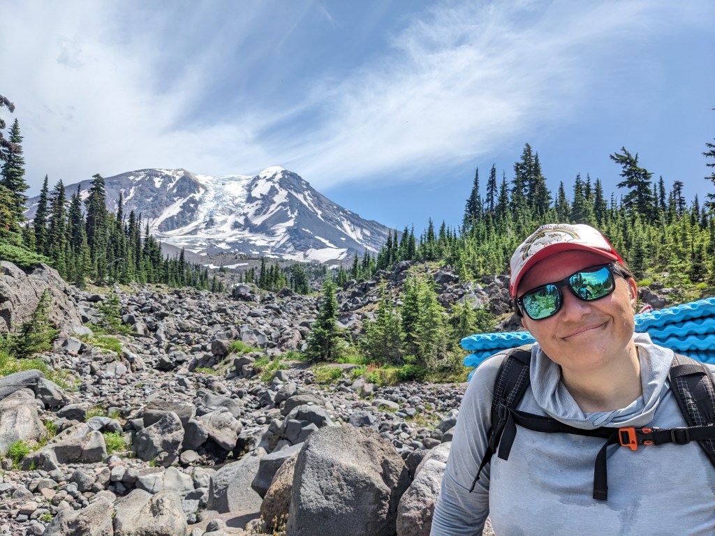
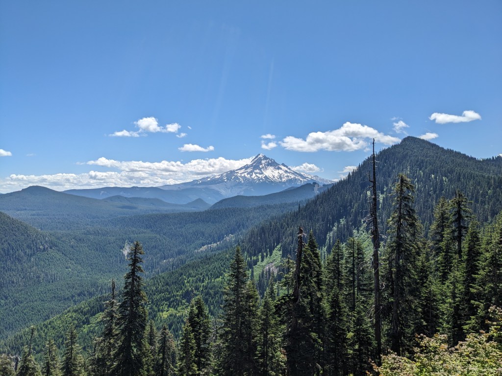
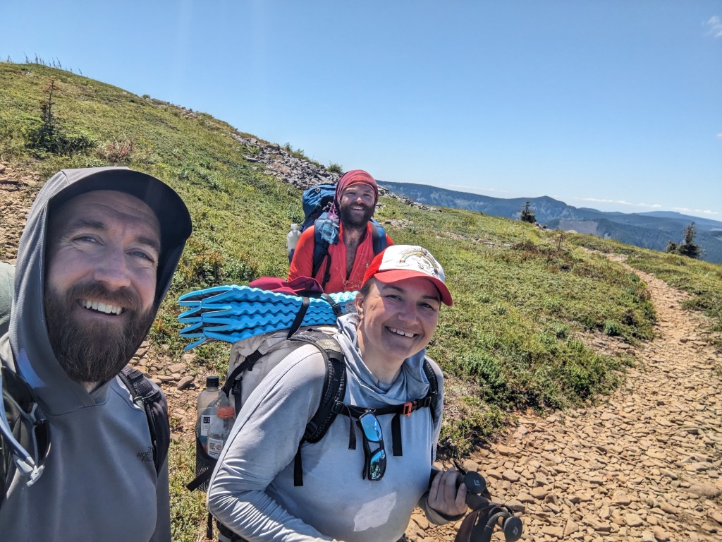
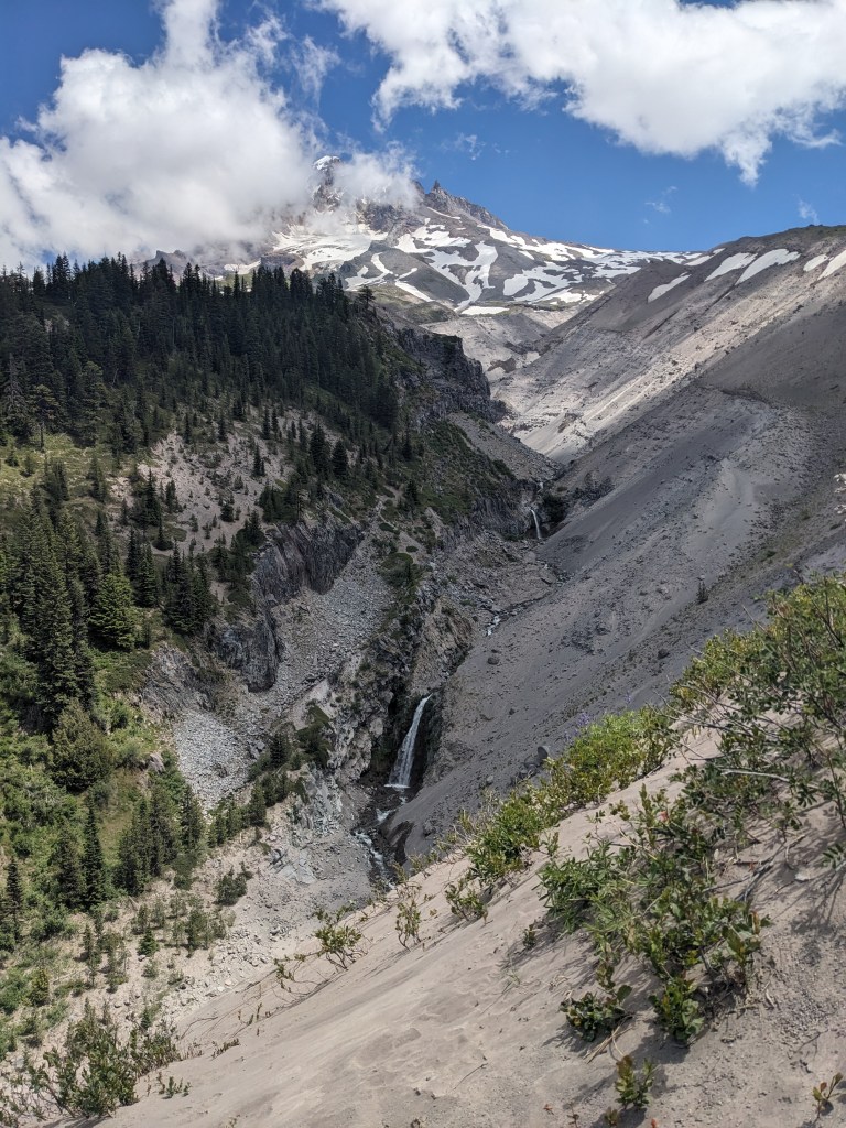
14 miles The day began with views of the Cispus River valley and then we started climbing up towards Old Snowy. It was a clear, bluebird day so we could see Adams, St. Helens, and Rainier while we worked our way up. Being a Saturday there are a ton of weekenders on the trail. A few thru-hikers too. We took the hiker route up to the saddle where there’s a junction that leads up to the summit of Old Snowy. Last time we came through here, we skipped the summit. This time, I went for it after seeing Yardsale and Chickadee head up. Leaving my pack at the saddle, I was light on my feet, which was good because the scramble up was a little sketchy. Going up was easier than coming back down, but we made it roundtrip in about a half hour. Regrouped, a quick snack, and then down the Knife’s Edge. This section was exhilirating the first time, and was even moreso this time. We had full sunlight, clear skies, and a slight breeze. We also had lots of down-climbing on loose rock, which is taxing and slow. Happy to be done with that, we all took a lunch break in a small stand of trees on the first flat section. We agreed we weren’t going to make it another 13 miles to the highway, so we agreed to stop about 8 miles before, splitting up the last climb between tonight and tomorrow. The afternoon was cruisey, and I listened to music for the first time on this trip. My legs are sore if we’re not moving at this point, but I feel stronger than when we started. We might get pizza tomorrow!
Cispus River valleyThis snow patch was about 20 yards long the last time we hiked through hereSummit of Old SnowyThe group starting down the Knife’s Edge
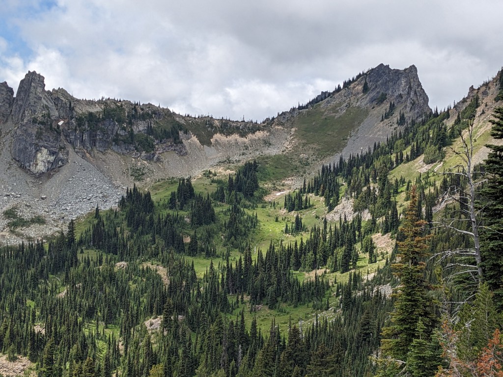
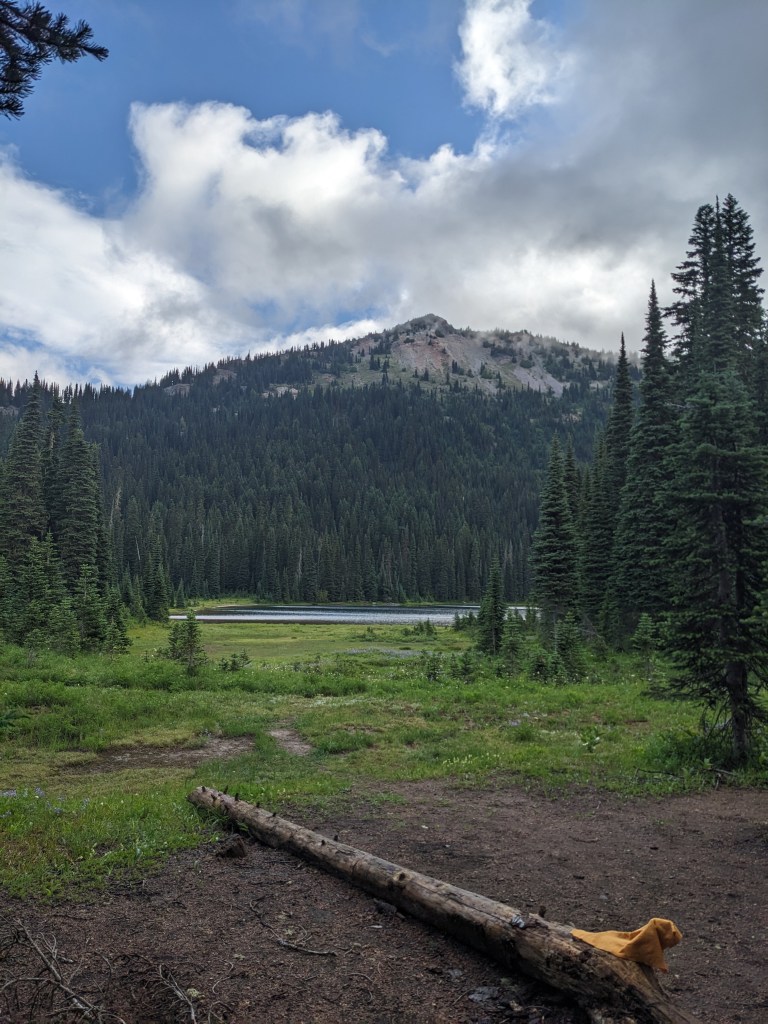
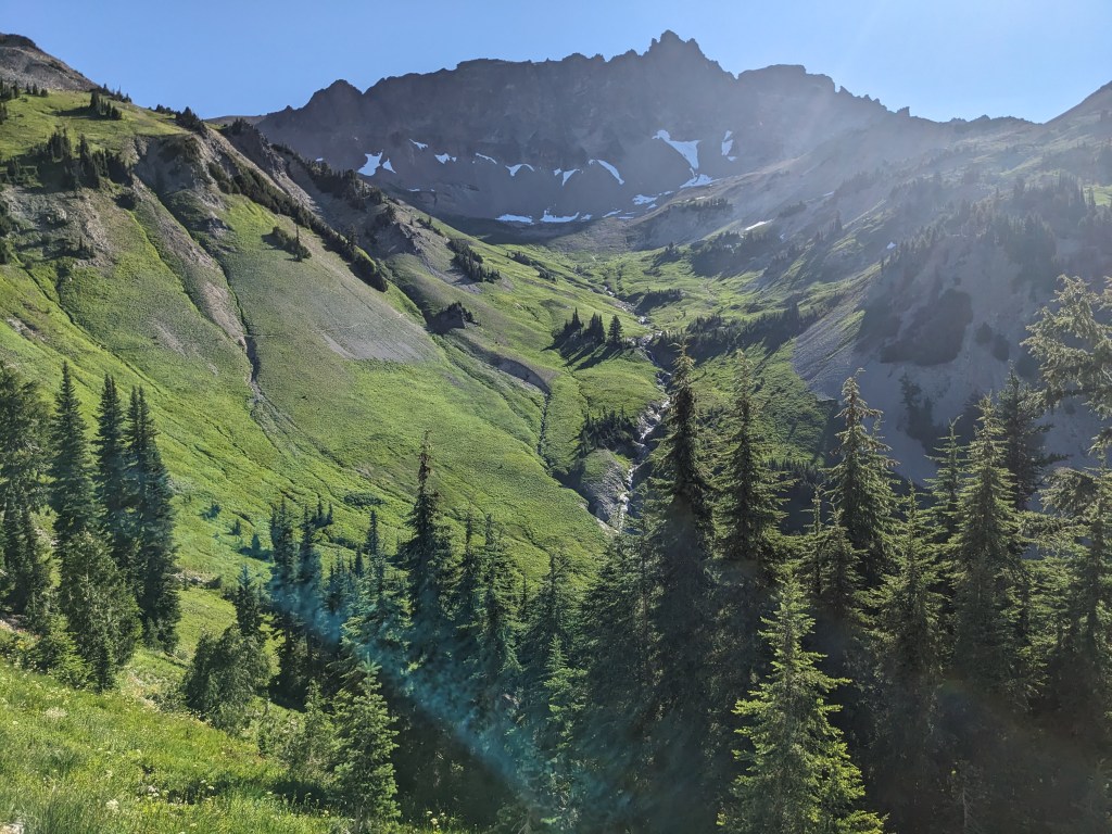
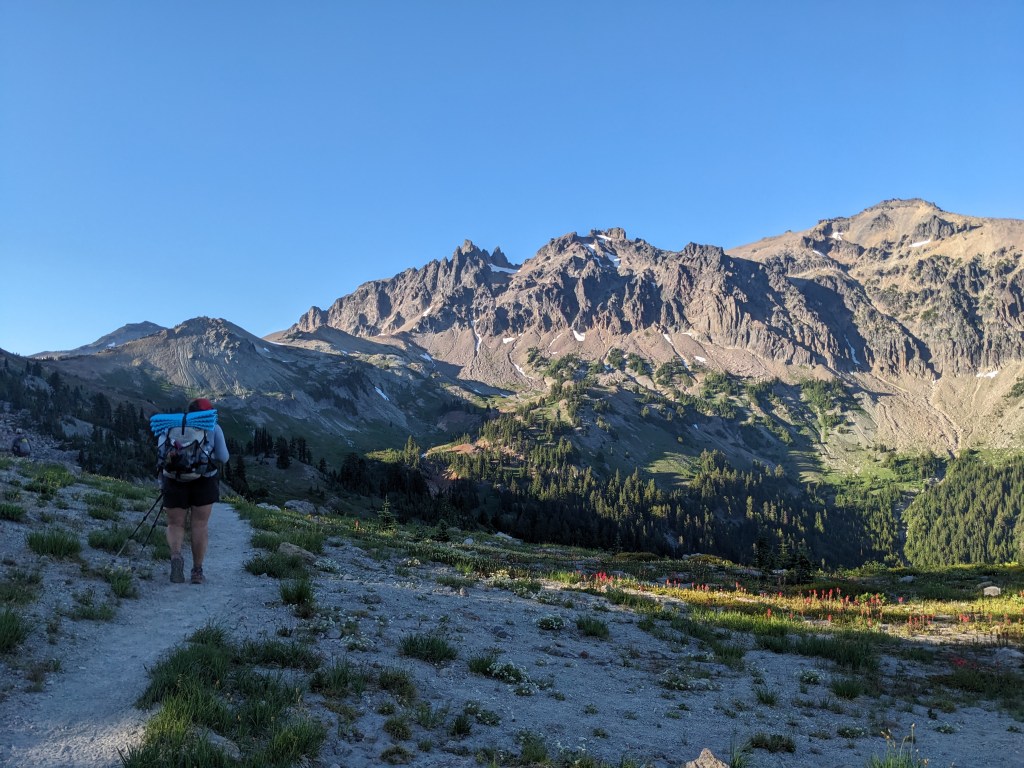
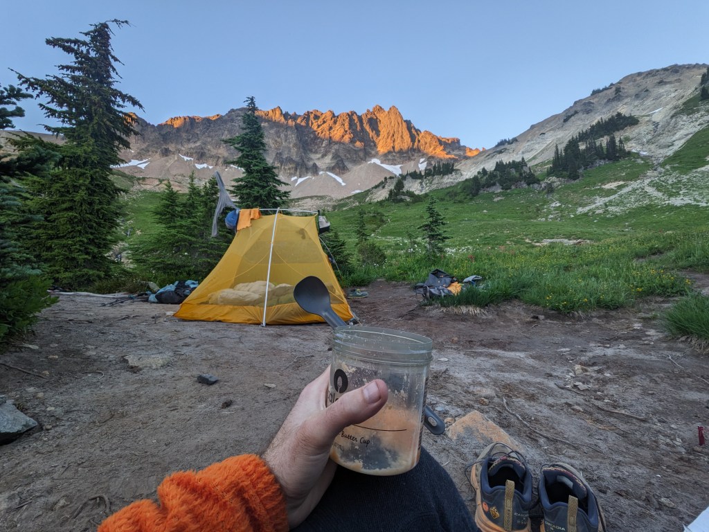
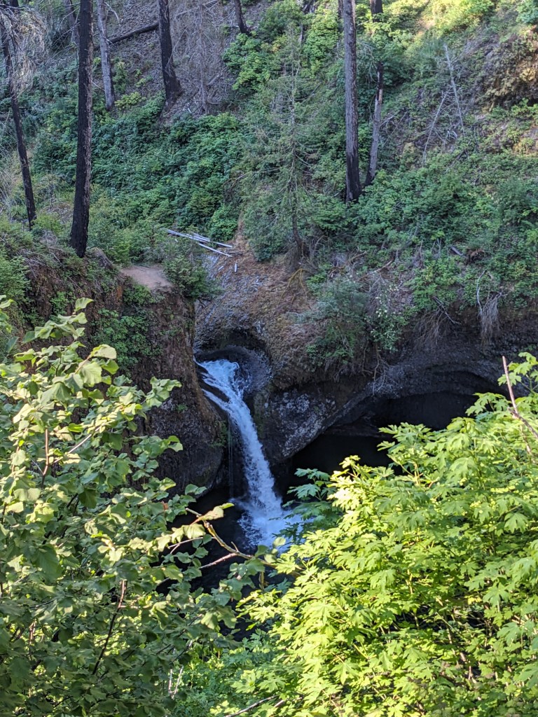
23 miles My quilt had droplets of condensation on it when I woke up, but laying it in a tree where the sun could hit it dried it right up. No one was in a hurry to get walking, but we eventually rolled out around 8:45. The first few miles were cruisey and rolly, and the mosquitos were always there with us. We had been warned by several SOBOers and they were not lying. Collecting water is the worst of it, you’re helpless! In the evening we made it up to Cispus Pass. It was one of my favorite sections of trail last time we came through and it remains that way. The approach trail has incredible views of Adams, when you gain the ridge you get this incredible valley, then the pass itself and coming down the other side into another massive valley. Just beautiful. You walk all the way around, waterfalls along the way. We are only doing part of the northern side of the pass today. Our campsite is shared with a trio of weekenders, but they don’t seem to mind that we’re here; our spots are fairly isolated from them. The view from this campsite is top notch.
Pulling away from AdamsThe group headed up towards Cispus PassSouth valley of CispusView from the pass looking SouthNorthern side of the passOur campsite was awesome
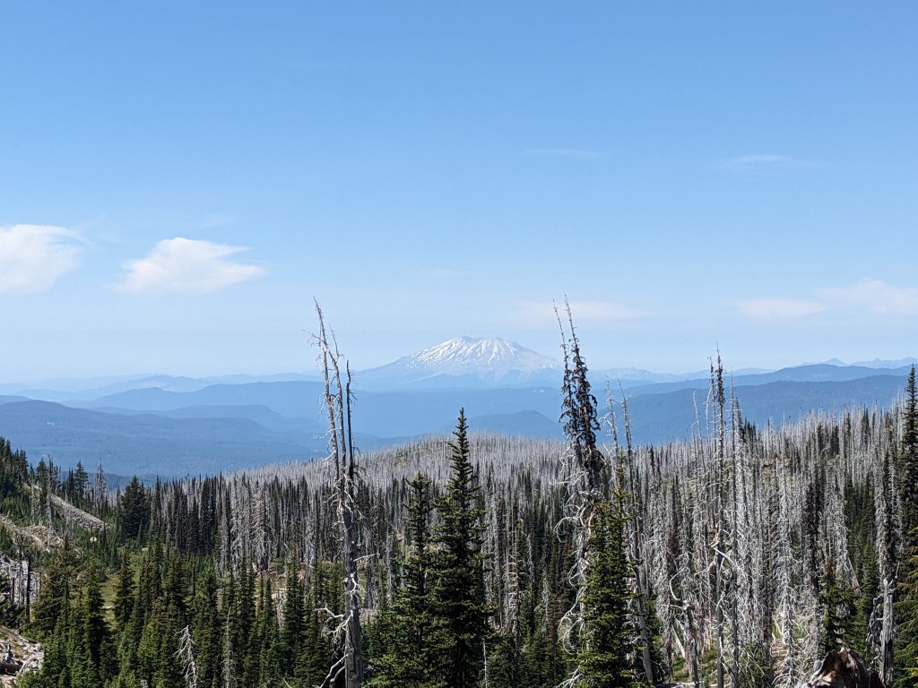
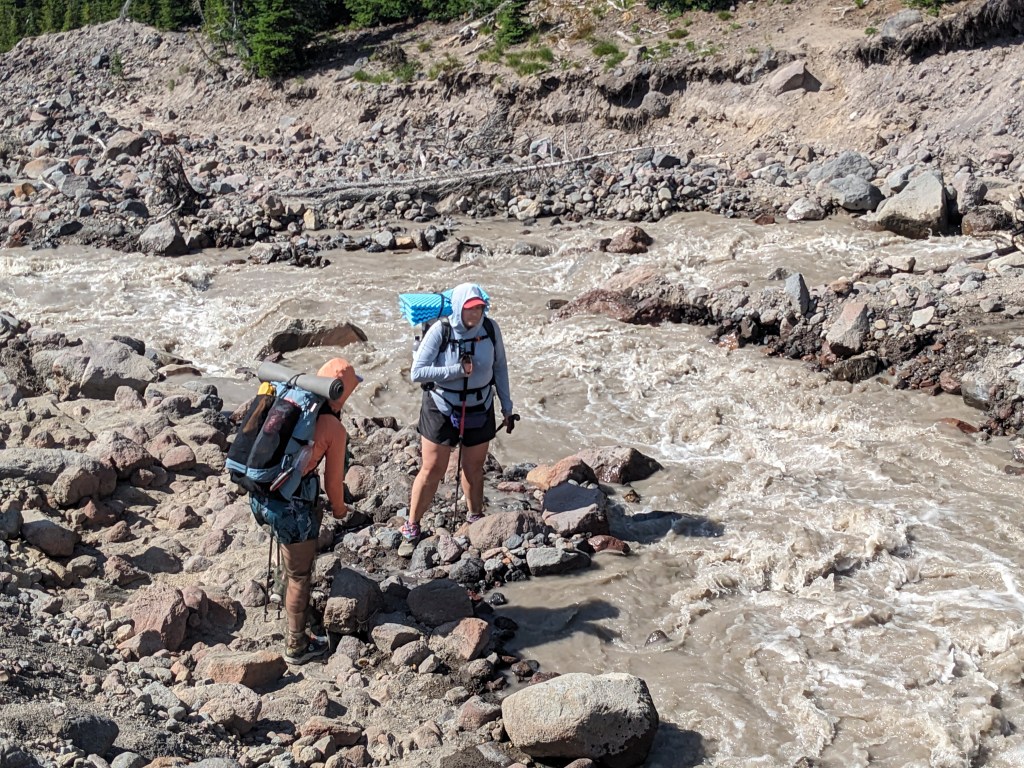
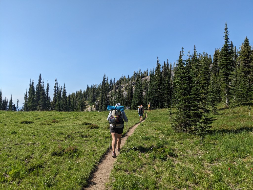
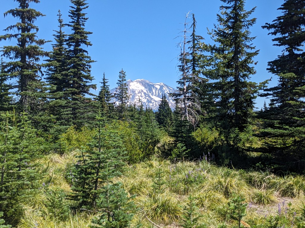
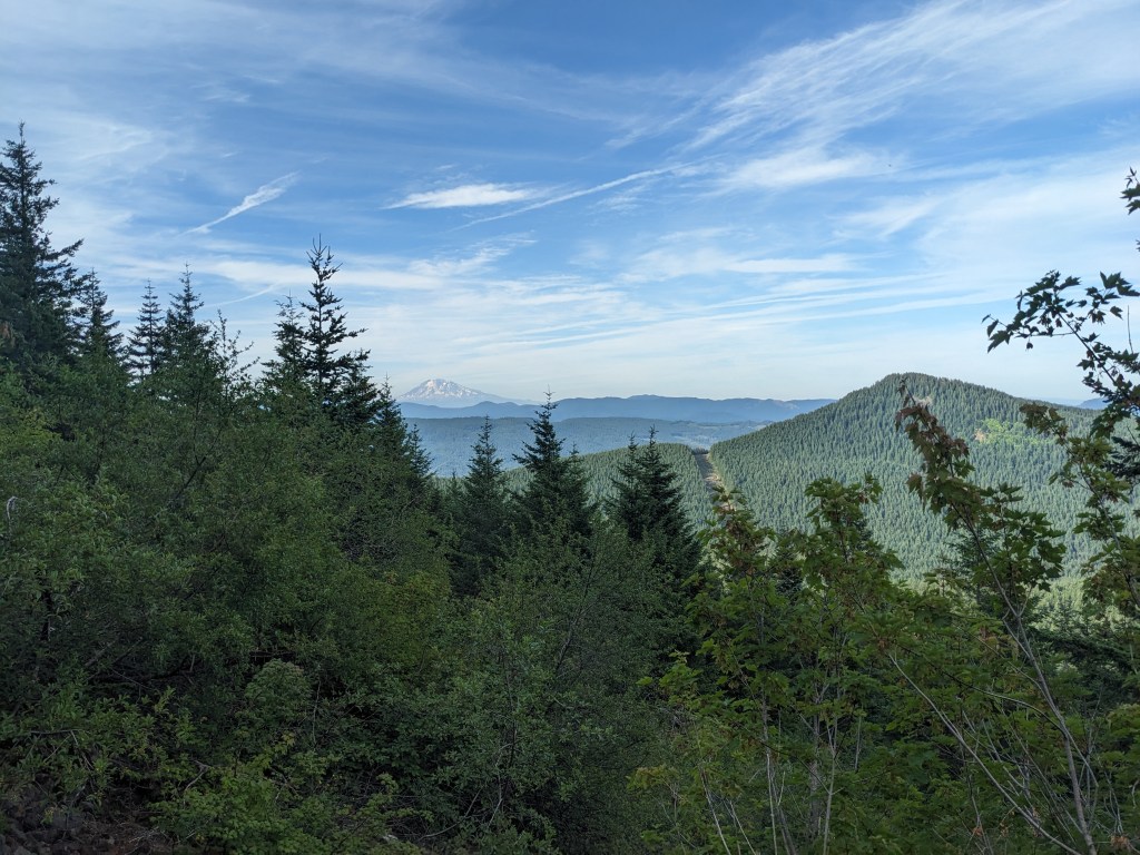
21 miles Everyone packed up and we walked over to the coffee shop, but it wasnt open yet. So we went to the cafe instead. It was full of old white dudes sipping coffee and bullshitting. Egg and bacon sandwiches were delicious, coffee too. We quickly finished up knowing we had to catch the 8:00 shuttle back to the trailhead. Dennis was our driver, a local guy, very nice and personable. When we got to the trailhead there were about dozen other hikers hoping to go into town on the return shuttle. Off we went for a casual climb up to some great views of Mt. St. Helens, Mt. Adams, and Mt. Rainier. After lunch we needed to cross Adams Creek, which was a bit sketchy. Yardsale went across upstream on some logs, then Marie started downstream in her socks in the water. The current was fast and glacial silt made it murky. Chickadee started over in her camp shoes and worked her way across, then Marie did too. I went up to where Yardsale crossed and did the same thing. The logs were wet and narrow, and I dunked my shoe in the process of getting onto them. But I made it over and we all regrouped. Cruisey downhills to camp. Ate dinner with Yardsale and Chickadee at Lava Spring.
Mt. St. HelensMt. RainierWorking around the base of Mt. AdamsChickadee and Drip about to cross Adams CreekThe four of us crossing a meadow
5 miles Cruised through the 5 miles to the forest road in the morning. Caught a hitch after waiting a bit. Crammed 4 people into the back seat of a truck, plus one in the bed with a bunch of camping gear the pair already had and our 5 backpacks. Made it to the cafe in time for breakfast this time. We had been hanging out with Yardsale and Chickadee at most of our breaks yesterday, and basically all day today. Its been fun getting to know them and cracking jokes. Laundry at the general store, resupply from there too, and showers at the campground around the corner. Trout Lake loves hikers and it shows, great little community. The church lets hikers camp behind it (donation-based) with portapots and outlets under a pavilion. No other hikers came so it was a great hangout spot for the 4 of us. Aiming for the 8:00 shuttle back to trail tomorrow.
I remember walking this small meadow last time, it seems greener now
22 miles Marshmallow was gone before I got up, but Yardsale and Chickadee were still around. We talked a quick gameplan for the day to get close enough for the hike out to Trout Lake tomorrow morning. Rolling terrain today, no major climbs. 13 before lunch and then 9 after to camp. The morning was a little rough because I gambled on some water sources that turned out to be dry. As soon as we broke from lunch, Ghost walked up. He had done 42 yesterday coming out of Cascade Locks, which means about 11,000 ft of gain for the day. With 26 behind him at 2pm he still planned to hike for 6 more hours. The bugs today got bad, to where we started wearing headnets while hiking. Swatted at them all day, and occasionally applied bug spray. They only swarm when you stop moving, so we took far fewer breaks. Camp was already occupied by some day hikers. We asked if we could join them at their site, and they didn’t mind. As the evening rolled on, more and more hikers rolled in and this giant space is now nearly full. It’s a cool spot next to a river with huge trees all around. Day hikers who ignore campfire bans are idiots though. Looking forward to town tomorrow, a shower and beer awaits.
22 miles Turned out to be a beautiful night full stars and the sound of the river flowing by. We got moving and headed for the Panther Creek campground, which would allow us to use a toilet, empty our trash, and then get water from Panther Creek. We needed to carry for 9 miles and 3200ft, and it ended up being a relatively smooth hike up. I think a large part of that was the weather being cooler. It was rather cloudy and at times it sprinkled a bit, so we stopped at one point to put in our pack liners and bring all the rain gear up from the bottom of our packs. First time we’ve needed that stuff, which I’m glad. At the top we stopped for lunch with Yardsale and Chickadee. They’ve been going roughly our speed and taking many of the same breaks most of yesterday and today so we’ve chatted a bit. They even cleared a spot to camp since we were all headed to the same point. We met Marshmallow, who we also saw at lunch, who is trying to catch up to the other members of her group. She joined our group at the end of the day, which I’m glad, she seems like she wants company. One of the guys in her group was staying in the room next to ours in Cascade Locks, small world.
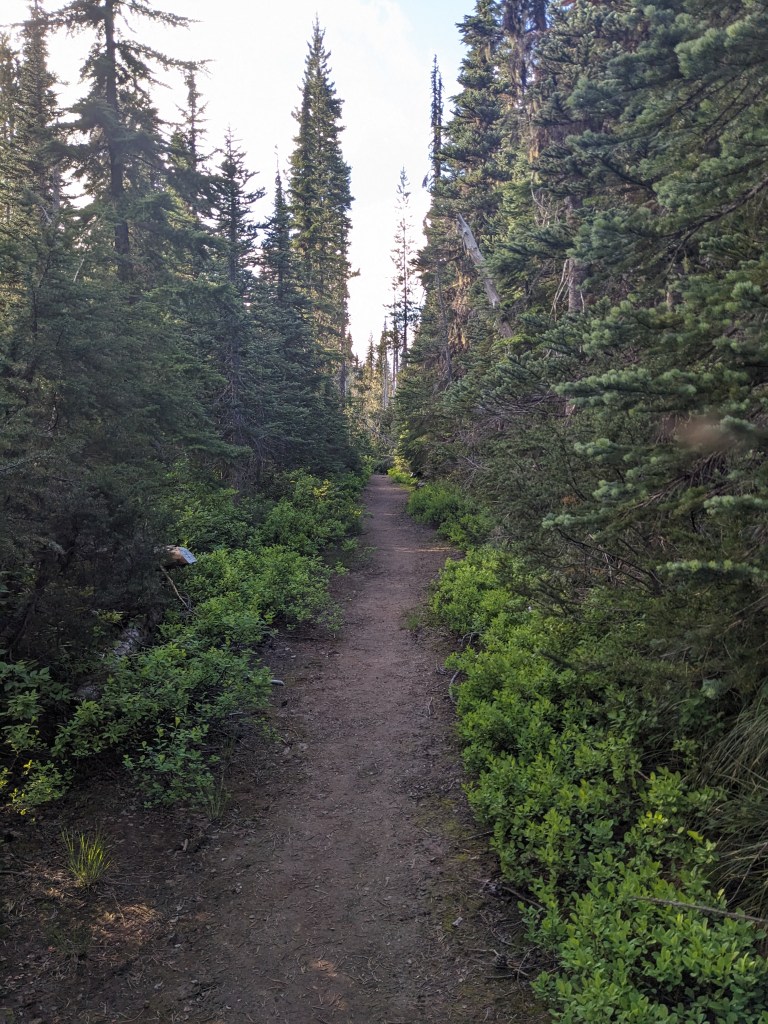
Storm clouds coming inI think I took this same photo last time. Trail feels like a hallway
20 miles The last ones to leave camp, we began the day dropping back down the other side of the hill we climbed yesterday. Most of Washington will be this way, gaining a ridge and then descending it. At our first major water source we chatted a bit with Cowbells. Chickadee and Yardsale were there as well. Everyone filled up and then started the climb as the heat of the day got worse. At the top, we stopped for lunch in the same spot we stopped last time we hiked this section. Yardsale and Chickadee were already there and welcomed us to join them. It was good to be off our feet and relaxing in the shade. The afternoon we descended our way to Wind River. The only spots available here are on a rocky berm on the river, so we’re cowboy camping for the first time.
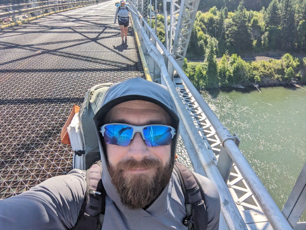
12 miles Today was a scorcher! We got up slowly from the comfort of the hotel room, and Jay invited us to breakfast with him, Malcolm, and Sprinter. They had all finished their meals before we got there, but were hanging out a bit longer before starting up the climb into Washington. We crossed the Bridge of the Gods and then up the trail. The heat advisory turned out to be true, the climb was brutal. The highest my watch said was 97 around 5pm. Along the way, we passed a pair of section hikers who had just completed the first mile of their hike. Their plan was to stop and take a short break every mile, and shoot for 10 miles a day. That sounds so nice and leisurely, but I would find it frustratingly slow. They seemed jazzed to be starting their adventure though and that was fun. I’m glad I’m only carrying 4 days of food since they had 8. Malcom and Sprinter only have 3 for this stretch to Trout Lake. We likely won’t see them again since they hike bigger miles than we do and they’re already ahead of us. They intend to flip back down to Chester southbound to do the Sierras after they reach the Canadian Border. When we got to camp, there were already a few tents there, but we snagged a decent spot. There were 3 hikers stuffed like sardines in a one-person tent watching a movie on someone’s phone. Good times. This is the same camp spot we stayed at the last time we hiked this section.
Crossing into WashingtonUp into the rainforestHeading towards Mt. Adams
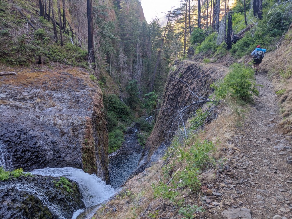
8 miles Paul was gone around 6, Jay headed out around 7, and we rolled out around 7:45. The miles down to the trailhead were fine, a bit rocky, but good weather and cool waterfalls throughout the canyon. Lots of dayhikers and a couple overnighters along the way. We had to do about 2.5 miles on a bikepath to get into town. On the turn to the path is the Cascade Fish Hatchery. We took a peek into the tanks and there were so many tiny fish wriggling around. It was cool to see. Breakfast was at the cafe under the bridge, where we changed into the least smelliest clothes we had and went in to eat. Afterwards, we met up with Jay who now had his car. He had gotten the bus to Portland and picked it up from the hotel where he left it a month ago when he started his hike of Oregon. Jay drove us to Hood where there was a WalMart that had more selection than the market in Cascade Locks. There was also a laundromat we could use. We saw Big Box and another hiker named Marie getting their resupply too. Grocery shopping done, we got dropped off to start laundry. Jay drove back to Cascade Locks, and then back to Hood to pick us up. His third trip of the day, but he didn’t seem to mind. Our chauffeur dropped us off at the hotel so we checked in and took showers. Our first in 9 days, since back in Sisters, 156 miles ago. Gnarly. Feeling fresh again, we joined Jay at the Gorges Brewing Company next door. Malcom (trailname is 90), Sprinter, and Ghost eventually joined us too. The other brewery in town, Thunder Island, gives a free beer to any PCT hikers, so we all went over there for more. On the way, Marie and I got soft serve ice cream. Delicious. Ghost told us about his plan to try for the FKT (fastest known time) of the Washington section of the PCT. He needs to average 40+ miles per day for 13 days over 506 tough miles and he’s doing it with all of his food from the start (unsupported style). He seems ready for it and should be starting at 4am Monday. We struck out on getting pizza since the shop closes early, so we got sandwiches to-go from Thunder Island. About ten minutes after getting back to the room, the power went out. The desk guy ran to flip a breaker and then we were good for the night. There’s a heat advisory for tomorrow, so we might be in for a rough day, we’ll see.
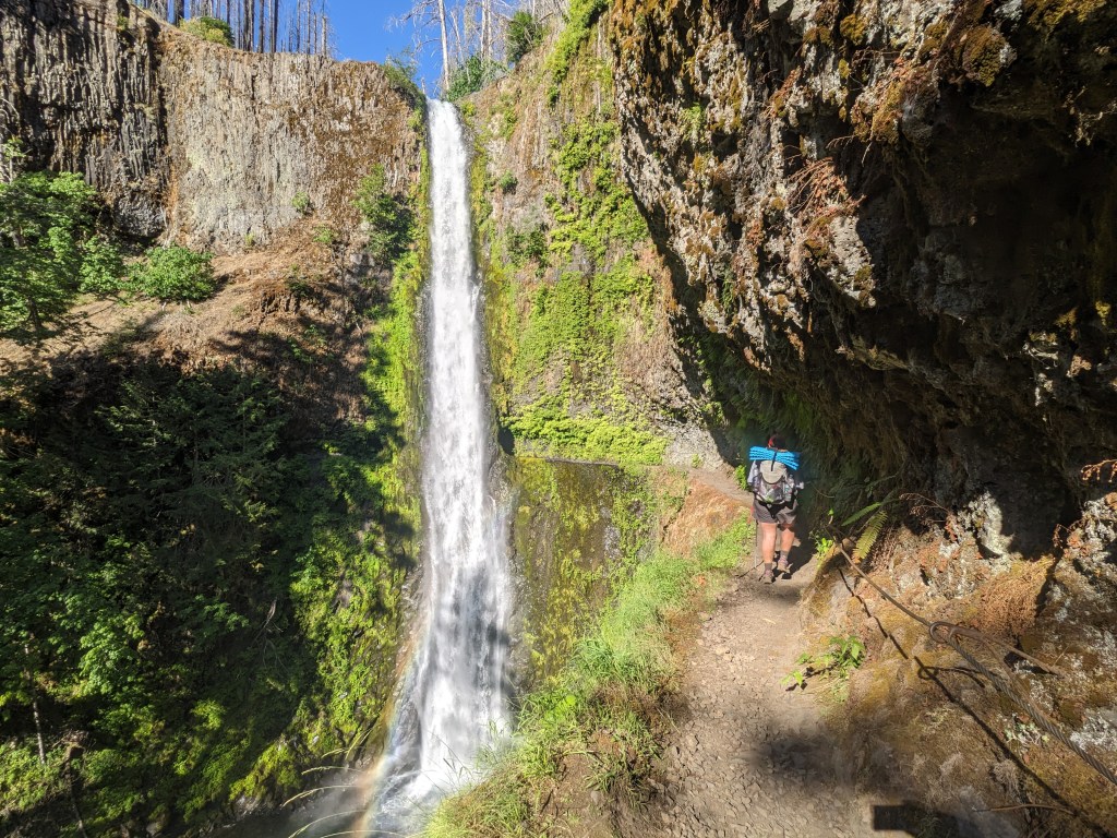
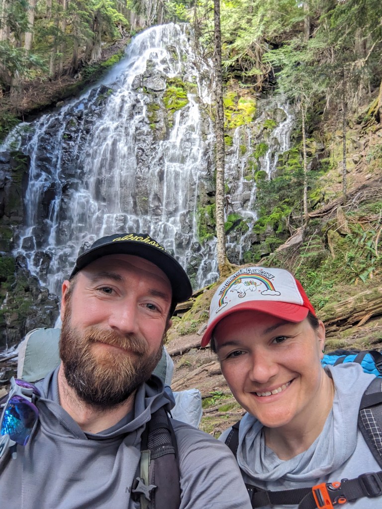
20 miles The sun woke us up again and Jay was already hanging out at the picnic table beside us. We chatted some more and slowly got around before heading out. The miles today started off easy enough, cruising through shaded trees. We passed a handful of SoBos, they also seem to think there’s a big bubble of them coming in the next week or so. Should be interesting to see them all pass by. We traded information about the upcoming segments and went on our way. Lunch was at the split for the Eagle Creek alternate. We heard the descent was rough, and it was every bit of that. Since it’s not the official PCT, the trail is not maintained to the same standard. Steep, lots of blowdowns, overgrown. But it’s also beautiful! The trail goes past a few waterfalls, most notably Tunnel Falls. You walk through a cave underneath the falls and the trail is carved into the side of the cliff. Very neat section of trail, although rough on the feet. Because it’s a popular destination for locals, we had to look a bit to find some open camp spots. Luckily, we found one with another PCT hiker. Turned out to be Paul, who we had met on Day 2 back at BLYC. Sitting my feet in the cool water felt amazing at the end of the day. Dinner around a fire ring with Jay and Paul was great. Just talking about anything and eating our various meals. Tomorrow is a couple hours of hiking in the morning and then Cascade Locks.
Looking back at HoodHiking with JaySteep canyon on the Eagle Creek altTunnel Falls
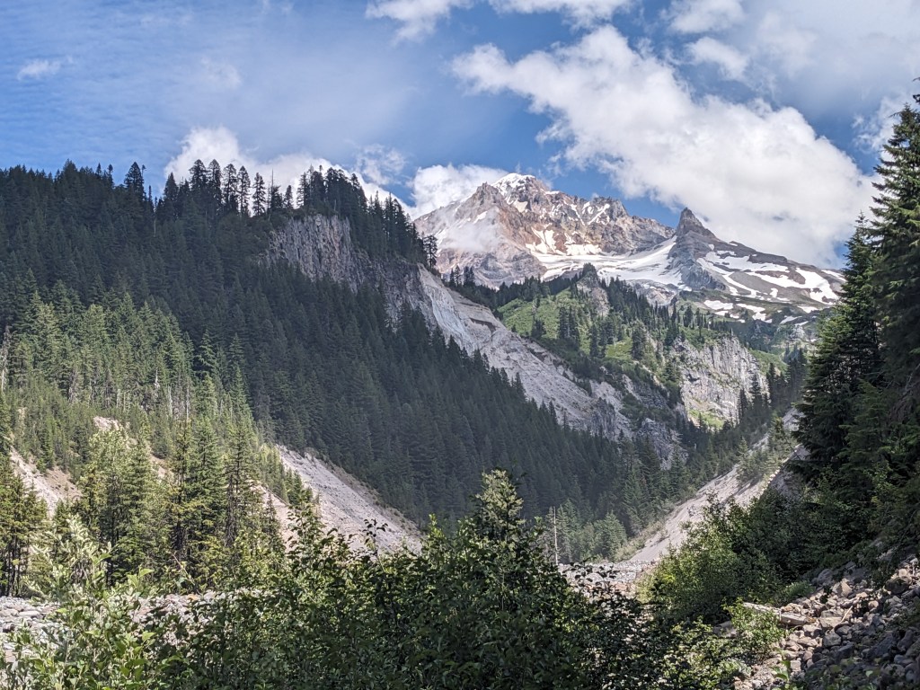
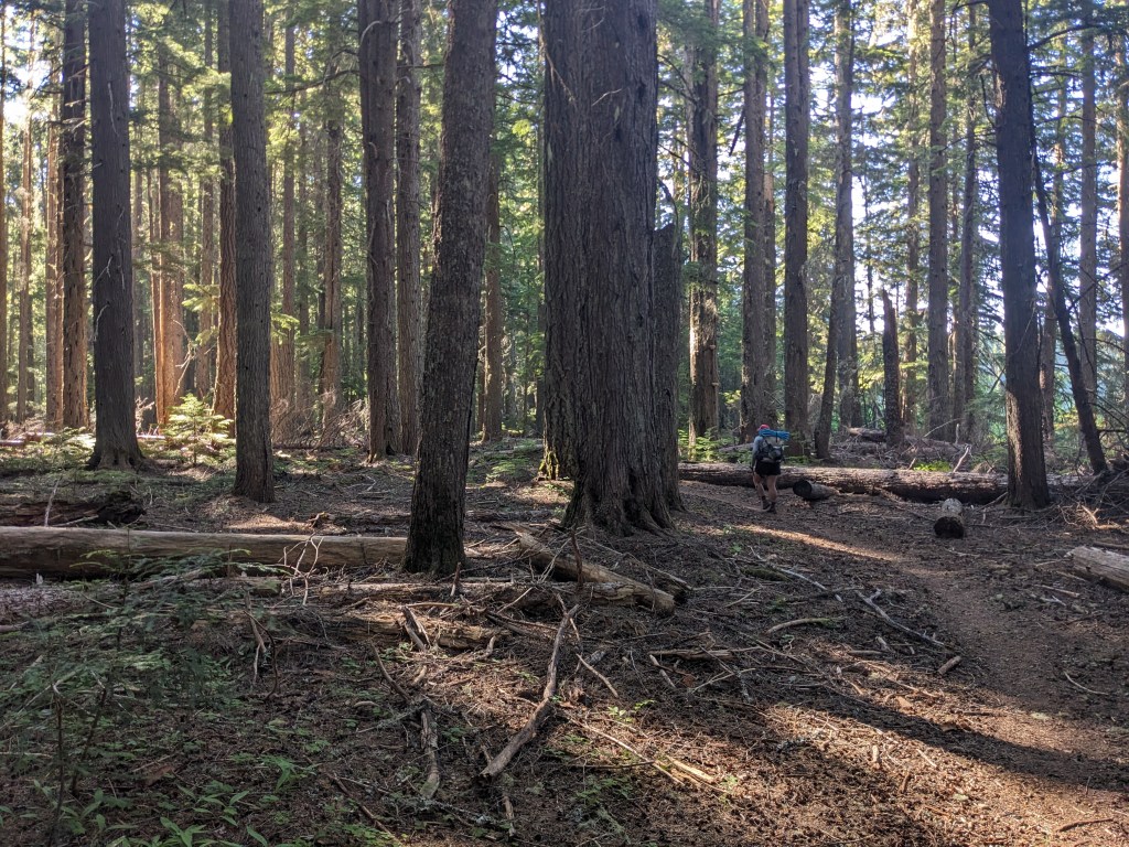
17 miles Our campsite had trees that shaded us from the morning sun, which can be annoying with this open air tent. Not complaining, just an aspect of it. The breakfast buffet was half-normal people, half-hikers. Jay was sitting with Malcolm and his friend, and Whimsy showed up eventually too. An older gentleman eyed me up and said, “You must be hiking the PCT.” Sure am! He told me he had also hiked it in 2013, but it was much different then. The snowpack in the Sierra has been a topic with nearly every hiker, and this man brought it up too. Most thru-hikers this year are skipping the Sierra and flipping down after the border. I imagine we would have done similar. I think the desert section would have been fun this year, to see snow, abundant water, and cool temperatures. Totally different than our year. After breakfast we poked around in the Lodge and then headed out. Along the way we passed two groups of PCTA volunteers doing trail maintenance. We got, what I assume are, our last views of Mt. Jefferson. It’s neat to see it so distant to the South when before it was so distant to the North. We’ve covered some hard miles this week and those views were earned. We are only about 24 miles to the Oregon-Washington border and that will close out Oregon for us (we are technically missing some miles near Ashland but whatever). Before we stopped for lunch, we leapfrogged a bit with Big Box. He was getting water right before a tricky river crossing. He chose to go through barefoot, but we decided to go upstream a bit to where it forked and cross the smaller portions. He made it across just fine, and so did we. Marie took her shoes off and crossed both portions, I managed to rockhop with dry shoes. Lunch was relaxing in the shade, the first time we have eaten lunch on trail without setting up the tent to keep mosquitos off. Our route today took us by Ramona Falls, which was beautiful. Some day hikers were standing behind the sign that said “Don’t stand here”. Idiots. The steep sections and switchbacks, mixed with the old growth forest felt very much like the section going into Dunsmuir. I guess it makes sense that over so many miles you’d get some deja vu. We rolled down to camp where Jay was already setup with a couple other hikers. He came out of his tent and chatted with us while we ate dinner. You meet a lot of people on trail and some you can quickly tell you’d get along with them in real life too. We’re planning to do about the same miles tomorrow and camp somewhere on the Eagle Creek alternate.
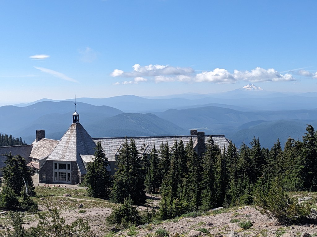
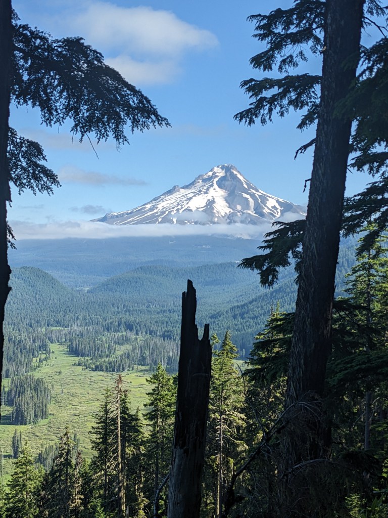
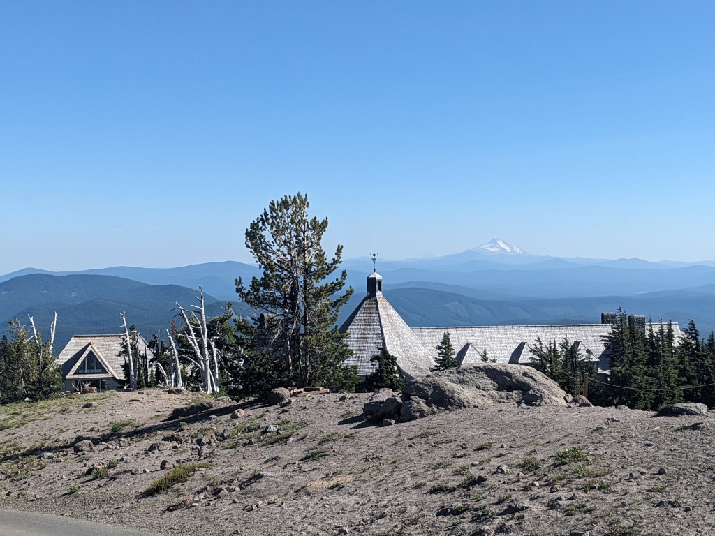
4 miles Not wanting to get bit by more mosquitos, we packed inside the tent until we had to get out and then packed that up as fast as possible. It largely worked. I sped down the trail, snapping a few photos of Mt. Hood along the way. I was eager to get to the trailhead at the highway. We caught a ride with Athena who was shocked we were hiking so far. We had a very brief, fun chat and she even took our picture before dropping us off at her exit. We walked a little to get to the other side of the interchange and then caught a ride with Christopher who took us the rest of the way to town. He worked for the forest service (I can’t recall if it was related to fire or not) and also wants to hike the trail some day. We went into Government Camp and started laundry. Next stop was Charlie’s for a burger and beer, and to recharge our phones. They played a bunch of late 90s punk rock so I was digging it. Our laundry was done, so we wrapped up at Char Bar and then picked up our clothes. Whimsy was there doing her laundry too. We walked down to Mt. Hood Brewing Company and hung out for awhile. It’s a brewery that’s just as much a restaurant so it feels weird changing into clean clothes in their bathroom. Jay chatted with us while he walked by, we were waiting for the $2 shuttle to Timberline Lodge. Whimsy got on the same bus and we made our way up Mt. Hood (the easy route, admittedly). There’s a campsite up the hill that PCT hikers can use and it has an incredible view of Hood. The buffet at the Lodge is a hiker favorite so we made our reservations for breakfast tomorrow. Our dinners in camp were to-go orders from the brewery today, town stops are great.
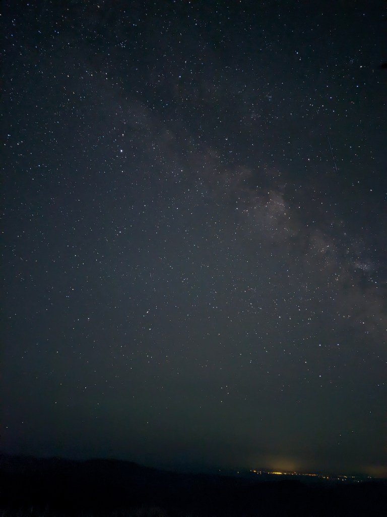
Mt. Hood on our way down to the roadTimberline LodgeView from camp above Timberline Lodge with Mt. Jefferson in the backGot a bit of the Milky Way from one of the night shots I took
18 miles Of course it started to rain last night about an hour after we went to sleep. Both of us woke up at the same time and quickly got out of the tent to throw on the rain fly. We rolled the dice on those clouds and lost. The funniest part is that it only sprinkled for about 5 minutes off and on for the next hour. Later during the night I felt a slight bump underneath my leg. It happened a couple more times, but stopped and I fell back asleep. In the morning after packing up the tent, we found a new hole had come up from where I was laying. Some animal must have tried to dig out, but got blocked. Hah! We passed by two SOBO hikers, Hamstring (during a previous hike on the PCT he had tore his hamstring near Scissors Crossing) and Short Leash (wife would divorce him if he hiked the PCT, but eventually she said he could do it). Lunch is in the shade in old growth. We’re outside Timothy Lake and there are planes flying over nonstop. We met a hiker named Jay who told us they were flying 6 planes as fast as they could to a fire closer to Cascade Locks. Will need to look into that when we get to Government Camp tomorrow. He was fun to chat with, even mentioned “freedom units” when referring to the temperature, which is much funnier to hear a person with an accent say out loud. Camp is next to a spring with 2 other hikers. They were very polite in letting us share the space. It can be awkward to pull up to the campsite we were aiming for and find that other people are already there. Thru-hikers, almost without question, will share their space with you if there’s room. Weekenders will likely not. You can usually tell them apart by their gear. Mosquitos in this spot are swarming, though we’ve avoided most of them by getting into the tent as fast as possible. Looking forward to doing laundry tomorrow, my clothes smell so bad. Also looking forward to a cold beer and a burger, but a shower will have to wait a few more days until we get to Cascade Locks.
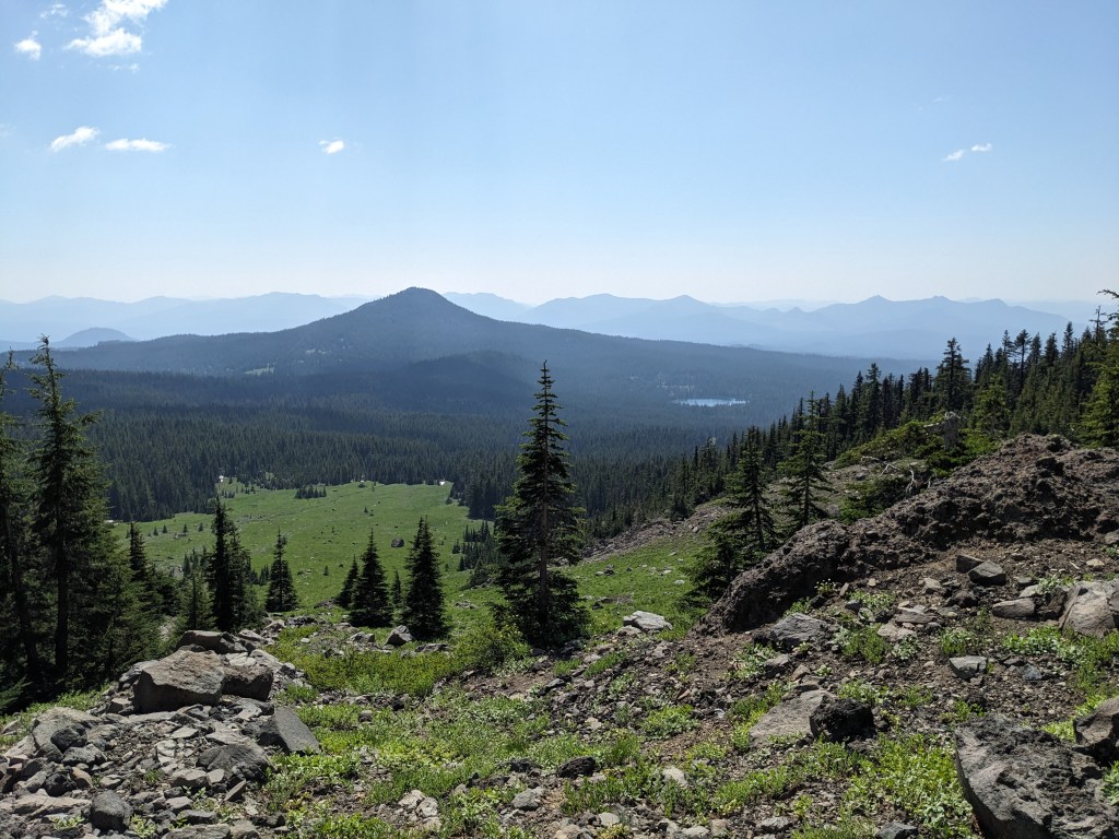
19 miles Group campsites can be fun, but the noise is an issue at times. One hiker packed up before the sun around 4:30, which was annoying, but I’m sure they were trying to go to sleep when we rolled in last night so I guess it’s all fair. Enjoying a slow morning, we got pop and candy from the resort store. We met Zap and Day Hiker, a couple from England, while hanging out outside the store. They were fun to chat with and hearing them say biscuit instead of cookie when referring to Oreos was funny. The hiking was cruisy in the morning and we covered the first 3.5 miles in an hour, which was a pretty good pace for us. Another few hours and we stopped for lunch at Lemiti Creek. Zap and Day Hiker had stopped there as well, but on the other side. We kept to ourselves though and ate and relaxed in the shade. The afternoon hiking was hot and slower than the morning, but we were super thankful to be passed the burn area and all of the blowdowns. Smooth trail is fast, and Oregon has very mellow elevation changes, so we can cruise when we’re feeling good. Our campsite tonight is next to Warm Springs River and we have a few neighbors on both sides. We got to camp early enough today to comfortably do camp chores (like wash our socks in the river). Hoping it doesn’t rain despite some clouds gathering low. The open mesh tent has been especially nice, I can see why people cowboy camp. Right before the stars come out you can sometimes see a bat swoop through the trees towering above.
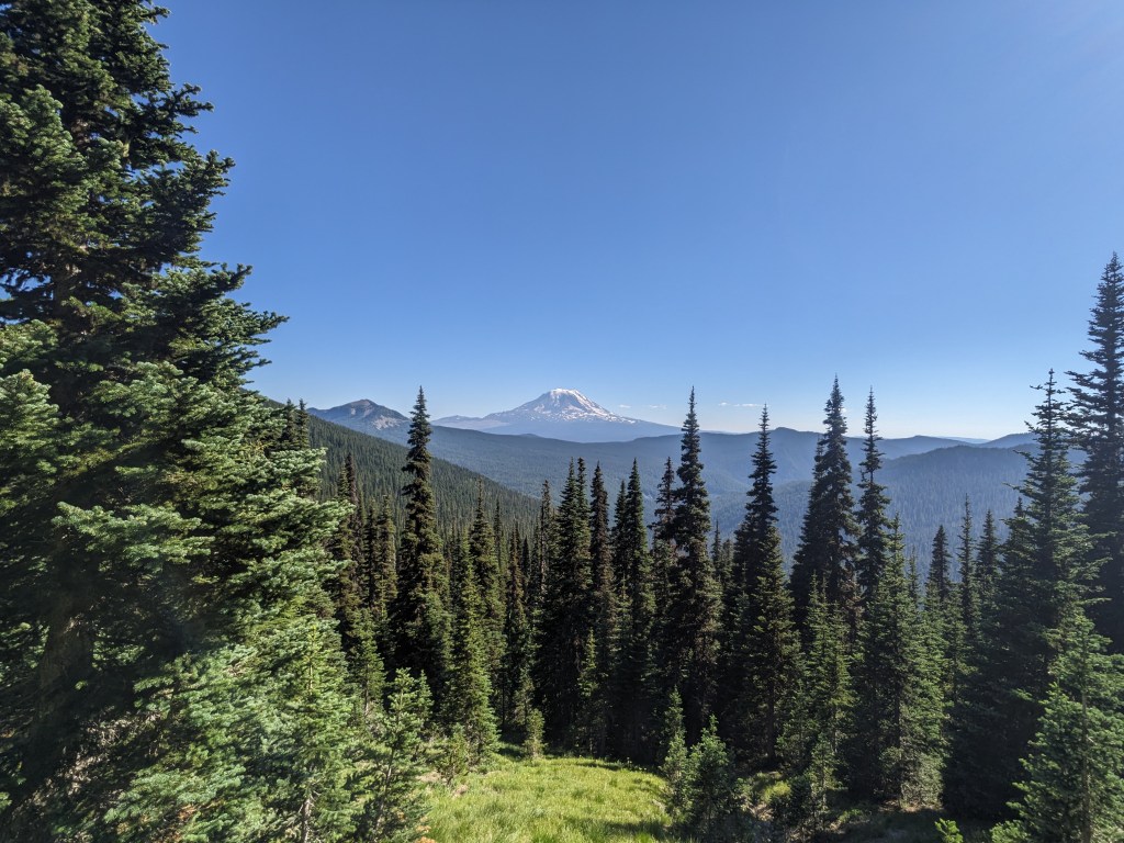
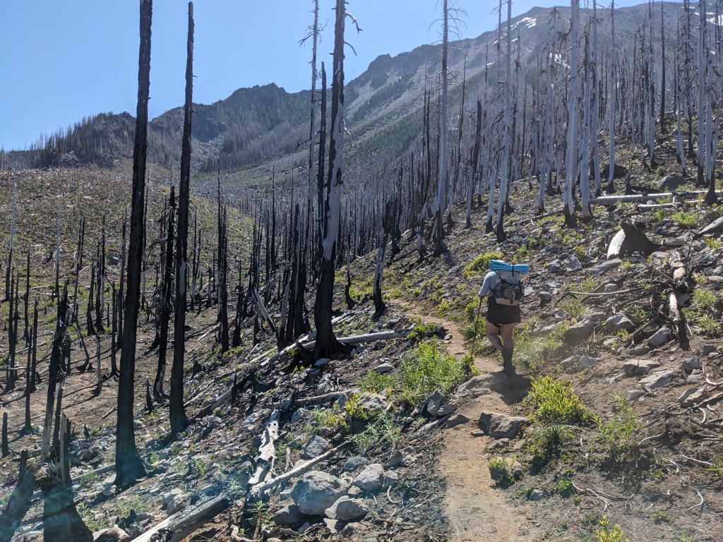
19 Miles A few hikers walked passed our tent in the morning, but we were still enjoying the shade from the bushes surrounding our spot. We rolled out around 8:15 and slowly made our way up through burnt trees. Along the way we passed by a couple of guys who were cutting up blowdowns. They had both hiked the trail before and gave us suggestions for upcoming stops in Washington. We continued on until we got to Russel Creek, which required some work to cross. Most of the miles today were working around Mount Jefferson. It’s incredibly tall and a few of the weekenders we passed yesterday would have been up there climbing it. I was happy to just be taking pictures of it from below. At the top of our own climb for the day we got our first glimpse of Mount Hood. For the second day in a row we ate lunch around 3pm and then worked our way down. The snow patches have been fairly easy to navigate, and I glissaded a couple of them. The rest of our miles were through burn area until we got to Olallie Lake Resort. They have a PCT Hiker area where we were the last ones to arrive. Marie was happy to get some fish tacos from a group staying at the resort who had made too much food. Whimsy was also camped there, and Carrot too.
Up and away from JeffersonFirst view of Mt. HoodJust before we got to Ollalie
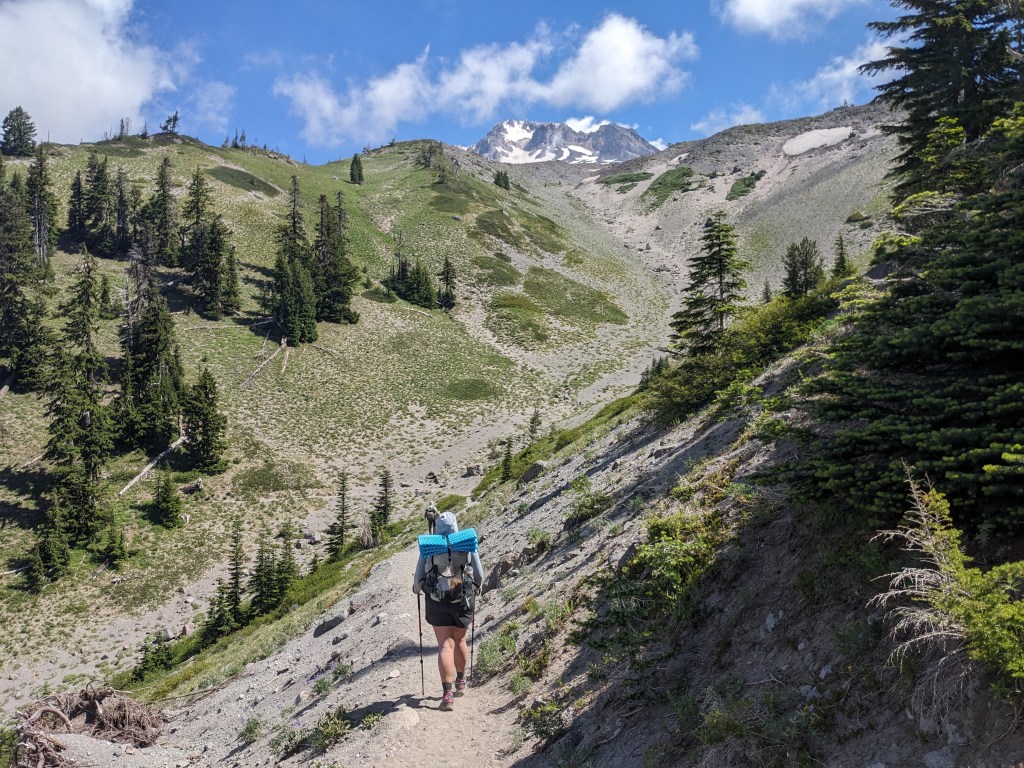
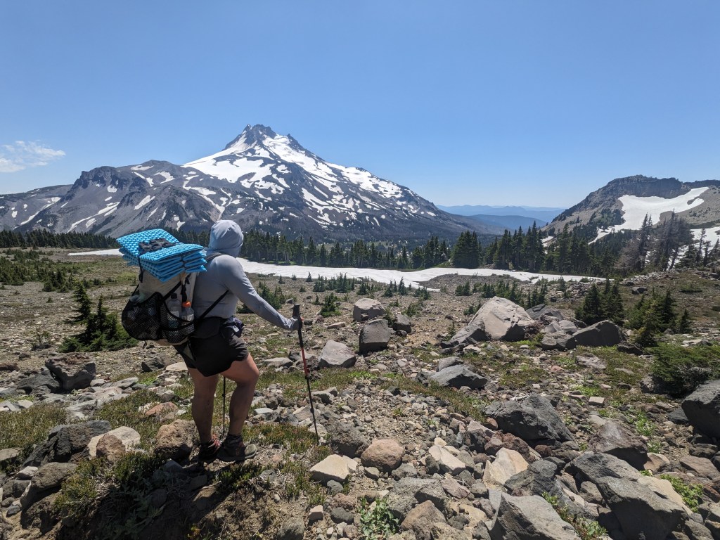
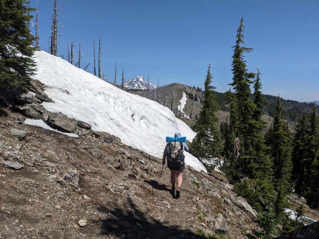
16 miles The start of our day was spent navigating more blowdown. Three hikers heading SOBO passed us almost as soon as we had started walking. We exchanged info about what trail conditions to expect for each other and then carried on. They said more snow patches to traverse and we said more blowdowns. They were right, and we spent a fair amount of time walking on snow throughout the day. Our first water source was Rockpile Lake, and we hung out there for awhile. We both got in to rinse off and cool down. Another hiker, Storytime (Storyteller?), joined us for most of that time. She is an outdoor guide for teens, ski instructor, generally a bad ass. She gave us cookies since she had too much food and was getting off trail in a few days. We also have too much food, but accepted the cookies since they were homemade from her mom. We told her how we were passed by Bag Bowl yesterday and she got excited. They had hiked together in SoCal and she was going to try to catch up to him even though he’s an extremely fast hiker. We all eventually packed up and started wandering through half-trail/half-snow. And some blowdowns thrown in for fun. If you’re not climbing over a tree, you’re trying to kick steps and maintain footing over snow patches. We stopped for a late lunch at Shale Lake where there were some weekenders enjoying the permit-required spots near the lake. One guy hung a bear bag, which got us talking about our storage technique, which is to just sleep with it. With some food and water put down, we cruised through the last 5 miles, mostly downhill, to our campsite near Milk Creek. I don’t have hiker hunger yet, so I had to force myself to eat even a few things. I have way too much food at this point. A climb awaits us in the morning so hoping for a good night of sleep.
Climbing over snow with Jefferson beyondLooking back to Three Finger Jack
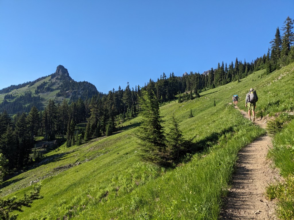
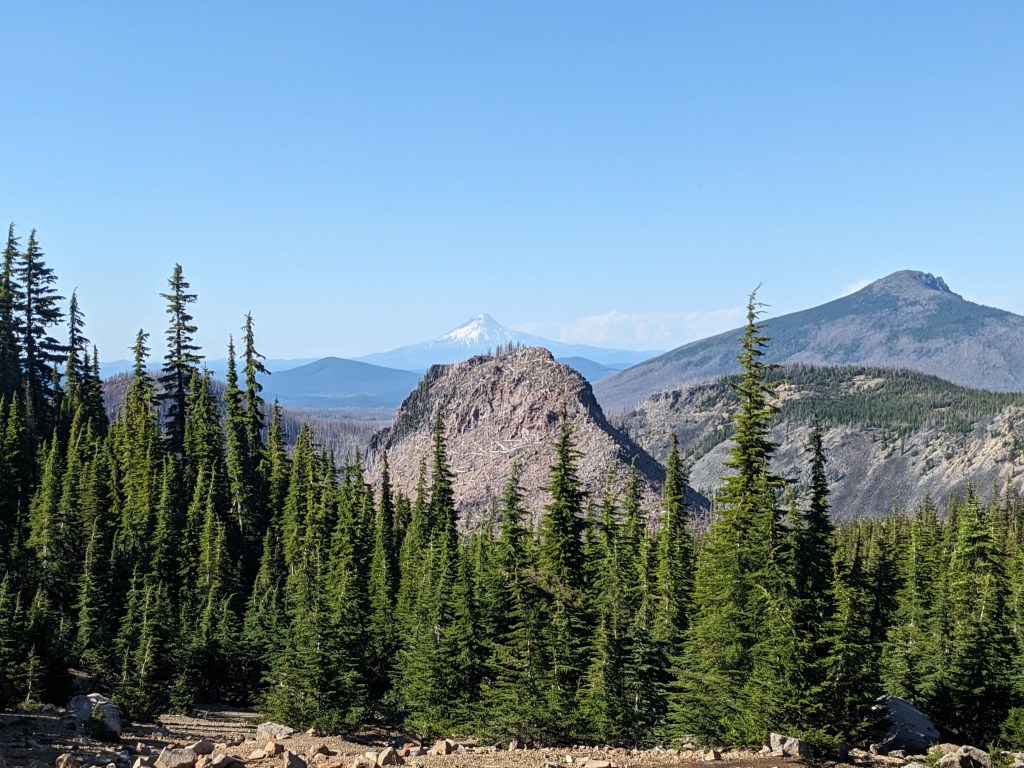
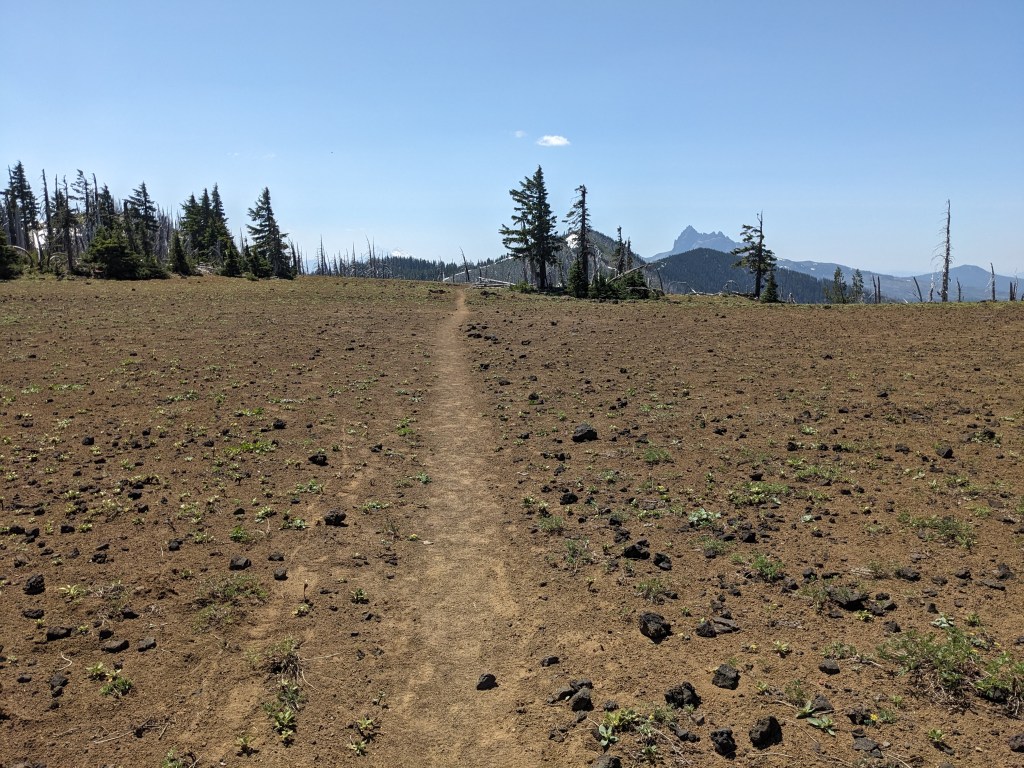
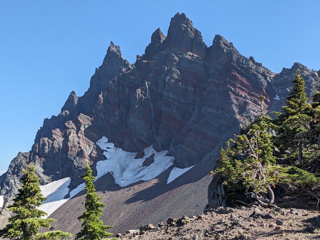
12 miles We used our town stay to get our issues more or less fixed. We got to Hike-n-Peaks in the morning to get a new pillow for Marie. We struck out on the other items, but they weren’t as vital so we are continuing on without. Two hitches on the way back to trail, the first from a guy that works at one of the summer camps in the area (but not BLYC), and the second from a couple in a van headed to Oregon Country Fair. All 3 were nice people and a big help to get up the highway and back to the trailhead. It was around 12:30 when we got moving, feeling ready but knowing the sun was working against us. It was a hot, dusty climb, but scenic and relatively easy. Later in the day we were passed by Bag Bowl who was moving fast. The views in this section were great circling around Three Finger Jack mountain. It’s neat to see it from three sides over the course of the day. The last few hours were tiring and slow because of the large amount of blown down trees. It also left few options for camping, and the spot we have I’m still nervous about. The wind is stronger than I’d like, but I’m hoping it dies down overnight and nothing falls on top of us.
Snow patches on the way up towards Three Finger JackThree Finger JackSlow going when the trail is like this